
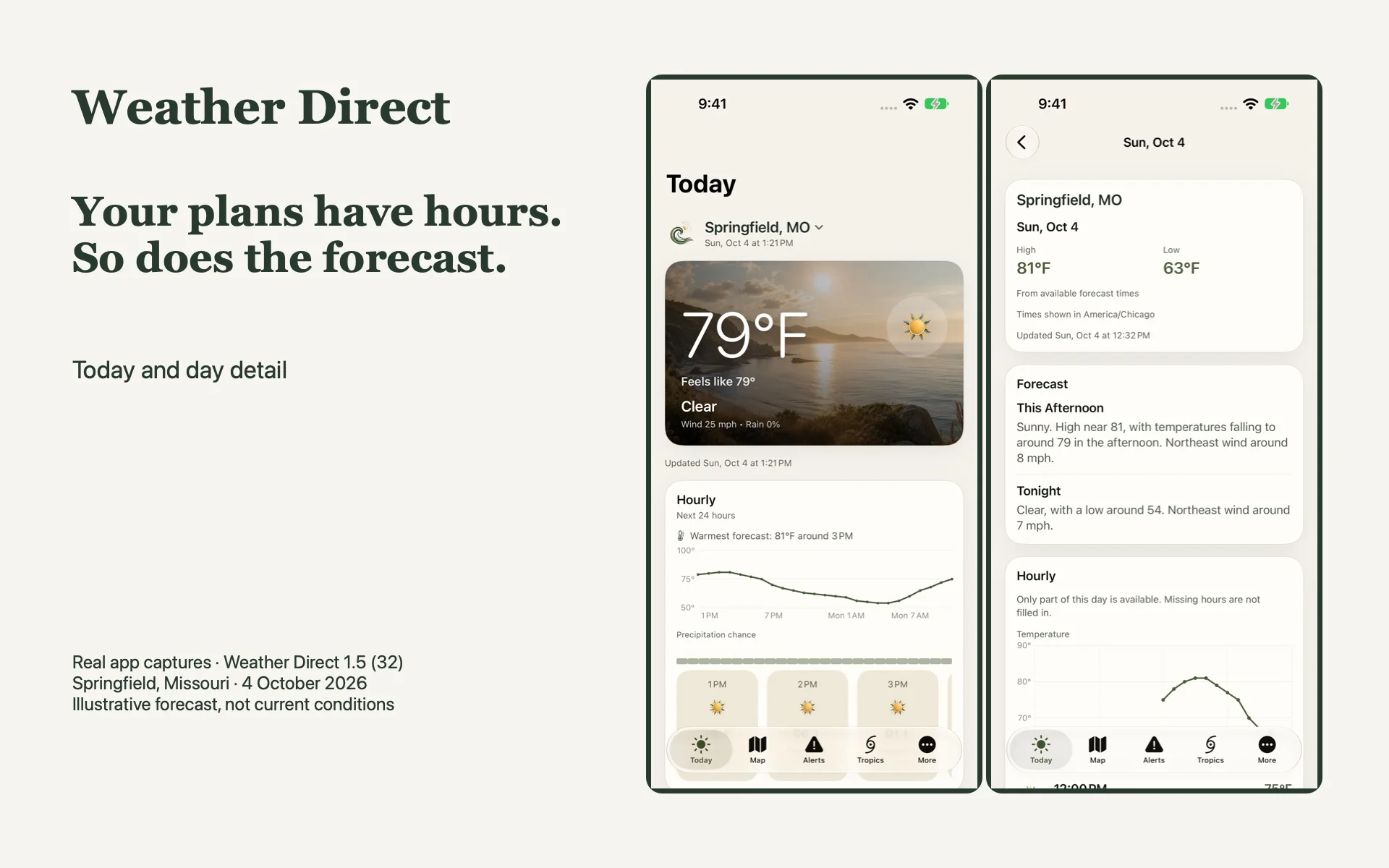
You're planning a Saturday barbecue. The forecast says 40% chance of rain. You've been staring at that number for ten minutes, trying to decide whether to fire up the grill or call it off. The percentage feels like it should settle the question. It doesn't — not in the way most people assume.
The percentage is a point and a clock
The National Weather Service defines probability of precipitation as the chance of measurable rain — at least 0.01 inch, or its frozen equivalent — at a specific point during a specific forecast period. A location and a time window. That's the whole definition.
A 40% figure does not mean rain will fall for 40% of the hours, or cover 40% of the area, or that the drizzle will last forty minutes. It doesn't tell you how hard it'll fall or exactly when the first drop hits. The complement is equally valid: a 60% chance of no measurable precipitation at that same point and period. Neither number is a verdict. It's a likelihood for a spot on the map and a slice of the clock.
If you're planning a two-hour barbecue, the all-day percentage is the wrong tool. You want to know what's happening during those two hours specifically. The NWS explains the convention in a short PDF worth keeping bookmarked.
The wind number that actually matters
Weather Direct’s current conditions show wind and gusts. It’s easy to read one number and move on, but the two tell different stories. In NWS observations, sustained wind is averaged over two minutes: the steadier background flow, not the strongest shove. That averaging interval is the NWS convention, not a promise about every provider’s readings.
A gust is a rapid spike. The peak gust is the highest instantaneous speed observed. A day reading 15 mph sustained with 35 mph gusts is not the same as 35/35. The average says the air is moving; the gust says something just nearly took your hat off.
This distinction matters when you're outdoors in an exposed spot. The NWS specifically warns that loose objects — patio furniture, trash cans, sports equipment — become projectiles in strong wind. If your barbecue is on an open patio with a folding table and a stack of chairs, the gust number is the one that tells you whether to bring the chairs inside before you do it the hard way. The sustained wind definition and the gust definition are short reads. The wind safety page covers what to secure.
Hours beat days for timing a plan
Ask three questions of an hourly outlook: when do we leave, how long will we be outside, and how long does it take to get back? The driest-looking departure hour helps little if the return trip falls in the wetter part of the forecast.
Suppose the chances are 20% in the morning and rise to 70% after three. That suggests an earlier start, not a magical dry afternoon. Move lunch forward, shorten the outing so you can finish before the higher-chance period, and decide where everyone will go if rain arrives early. A kitchen is a more useful backup than a determined expression.
Weather Direct shows hourly temperature trends and available per-day hourly details for your saved location, with times in that location's own time zone. For an hour-by-hour precipitation probability graph at a U.S. location, the NWS publishes one separately. It's a different tool from the app's display, but the planning logic is the same: look at the hours that overlap your departure, the activity itself, and your walk back to the car.
An hourly forecast is not an appointment with the rain. Use the pattern to choose a workable window, check again nearer departure, and leave room to change the plan. Don’t add hourly percentages or multiply their complements to calculate a dry-afternoon chance: adjacent hours share a weather system, not independent coin flips.
When the forecast stops being a suggestion
A severe-thunderstorm watch means severe thunderstorms are possible in or near the area. Stay informed, be ready to act. A severe-thunderstorm warning means severe weather is imminent or occurring. Take shelter in a substantial building. The NWS thunderstorm page lays out the distinction plainly.
Weather Direct displays available warnings, watches and advisories inside the app. It does not send weather push notifications. It does not replace Wireless Emergency Alerts, NOAA Weather Radio, or local emergency officials. Radar, alert and tropical coverage varies by region and supported source. Follow the actual official warning and its instructions. The app can help you check; it is not an alarm or a substitute for the channels your local authorities recommend.
Weather Direct is available on the App Store in the current U.S. listing for iPhone and iPad running iOS/iPadOS 17 or later. Forecasts in the US come from the National Weather Service; outside the US, from MET Norway.